Fogo is a sparsely populated island, with just 6000 people. It doesn’t have a lot of developed tourism infrastructure, compared to the other islands, so the number of tourists that come here is relatively small. Most people who do make the effort to visit Fogo are interested in tracking either around or to the summit of pico de Fogo, a massive volcano for which the island is named.
One of the biggest drawing cards on the island, apart from trekking, is to visit the village, Cha da Calderas, which is located within the walls of the greater volcano. It is a village that was completely destroyed by the 2014–2015 eruption. Originally, we had planned to drive to the Caldera to see the village and to get a close-up view of the cone of the volcano. However, after driving around the Island yesterday, which was far from an easy drive, not only due to the cobblestones, but also do to the frequently scary heights of the highway, we had decided it would be too much to drive to the Caldera today. We had envisioned a nonstop series of switchbacks to ascend to the top of the Caldera, followed by another never-ending series of switchbacks to then descend inside it. For a guy who is terrified of heights, it seemed like a bad idea.
During a discussion late yesterday with Waldo, the manager of the hotel, he explained to us that the road up to the Caldera is actually paved with pavement, not cobblestones. He said it’s a very modern and user-friendly highway and that there are no sections of the drive that have spine-tingling drops to an instant death over the side of the highway. He also clarified that the drive inside the Caldera to the village is on a fairly flat and good road, constructed after the 2014 eruption with cobblestones. All that to say, he encouraged us to reconsider, which we did. So we got up this morning and, after a leisurely breakfast, we decided to head out. It turned out to be the best decision! Hopefully the photos that follow will give you a sense of the experience and why it was one of those experiences we will never forget when we look back at all our travels.
It was around noon when we arrived at the village, Cha da Calderas. And it was 3 PM when we arrived back in Sao Filipe, where we had a nice lunch on a terrace and then saw the few sights the town has to offer. We ended the day sitting by the pool of the hotel for an hour, admiring the incredible view, followed by pizza at the hotel restaurant.
It has been a wonderful two days on Fogo Island, and we are so happy that we included this gem in our itinerary.
The Drive to the Crater
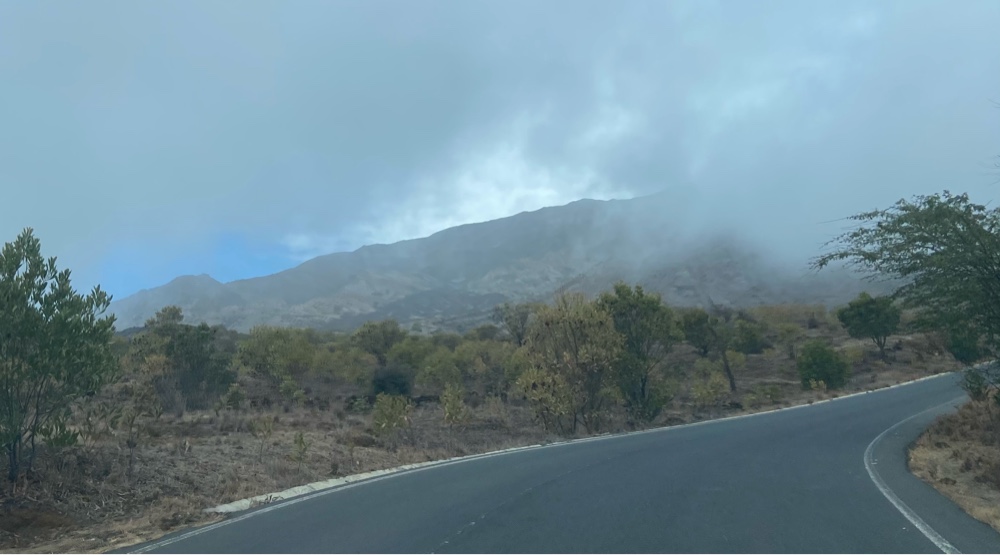 |
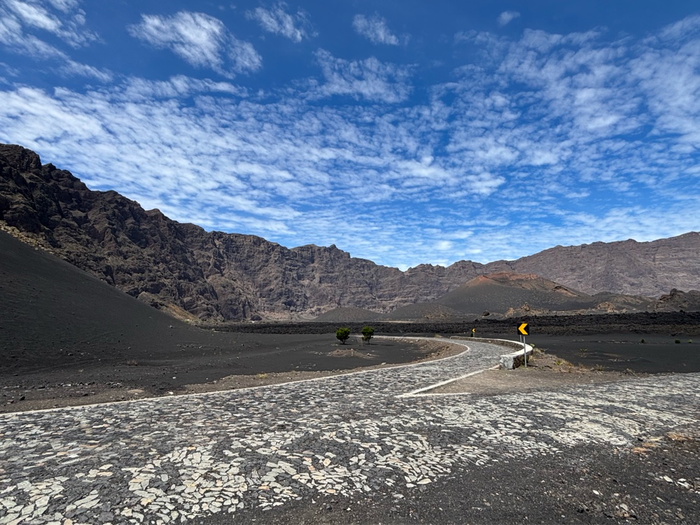
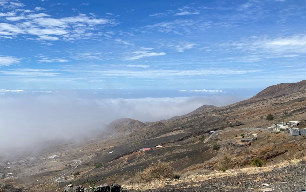
| Just as Waldo at the hotel had said, as soon as we turned off the cobblestone island perimeter road, we started on an impeccable newly paved road, with no drop-offs on either side. We immediately started ascending higher and higher through a series of switch-backs and, before we knew it, we were going through the clouds. |
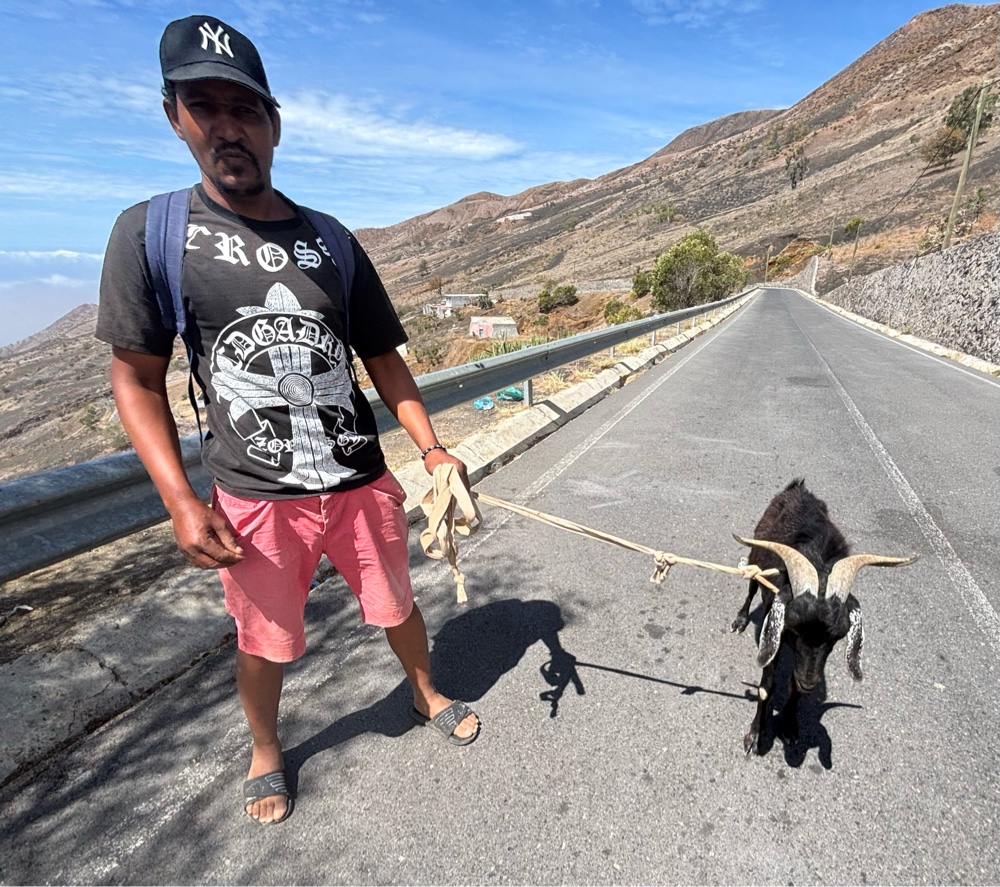 |
When we stopped to buy a souvenir from a roadside vendor, this friendly guy came by, walking his goat.
|
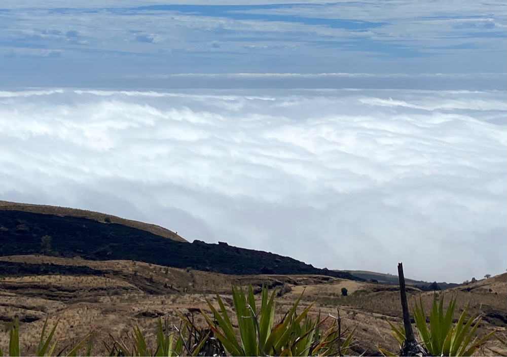 |
| Before long, we passed through the clouds. It’s amazing to be above the cloud line. |
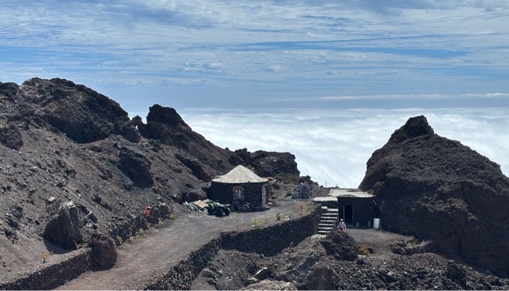 |
| Imagine living in a hut made of lava rocks above the cloud line! |
Parque Natural do Fogo
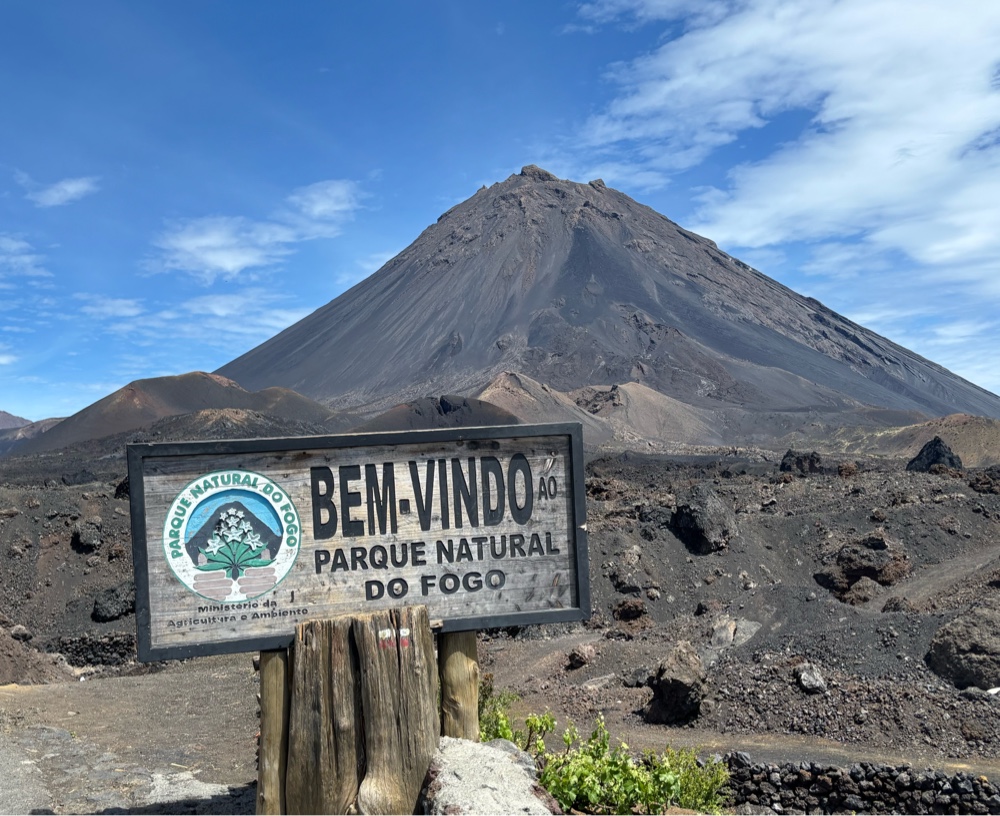 |
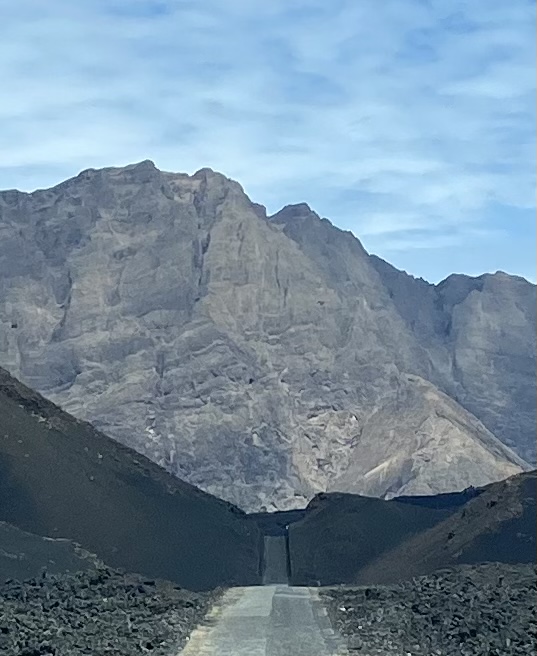
| Entrance to the Parque Natural do Fogo. Getting that first close-up view of the cone is truly spine-tingling. |
 |
| That’s the road into the crater. |
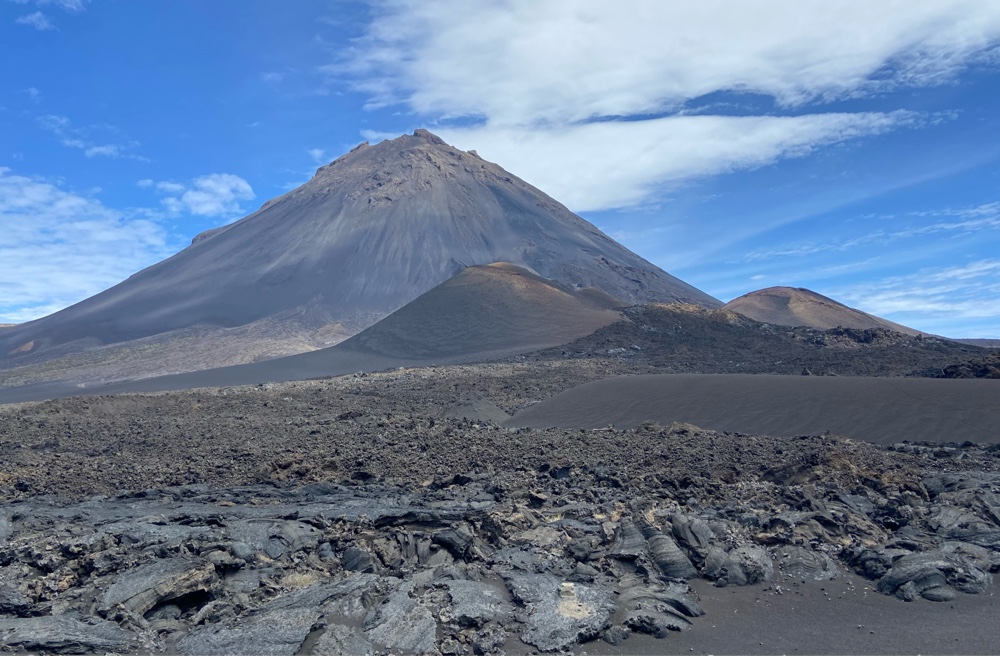 |
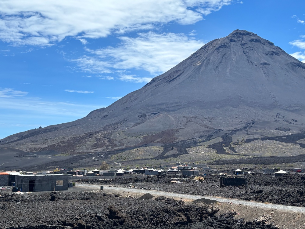
The main cone of the volcano goes back well before recorded European history, of course. The smaller cones (to the right and foreground) came later. The 2014-2015 eruption was on the side of the main cone.
|
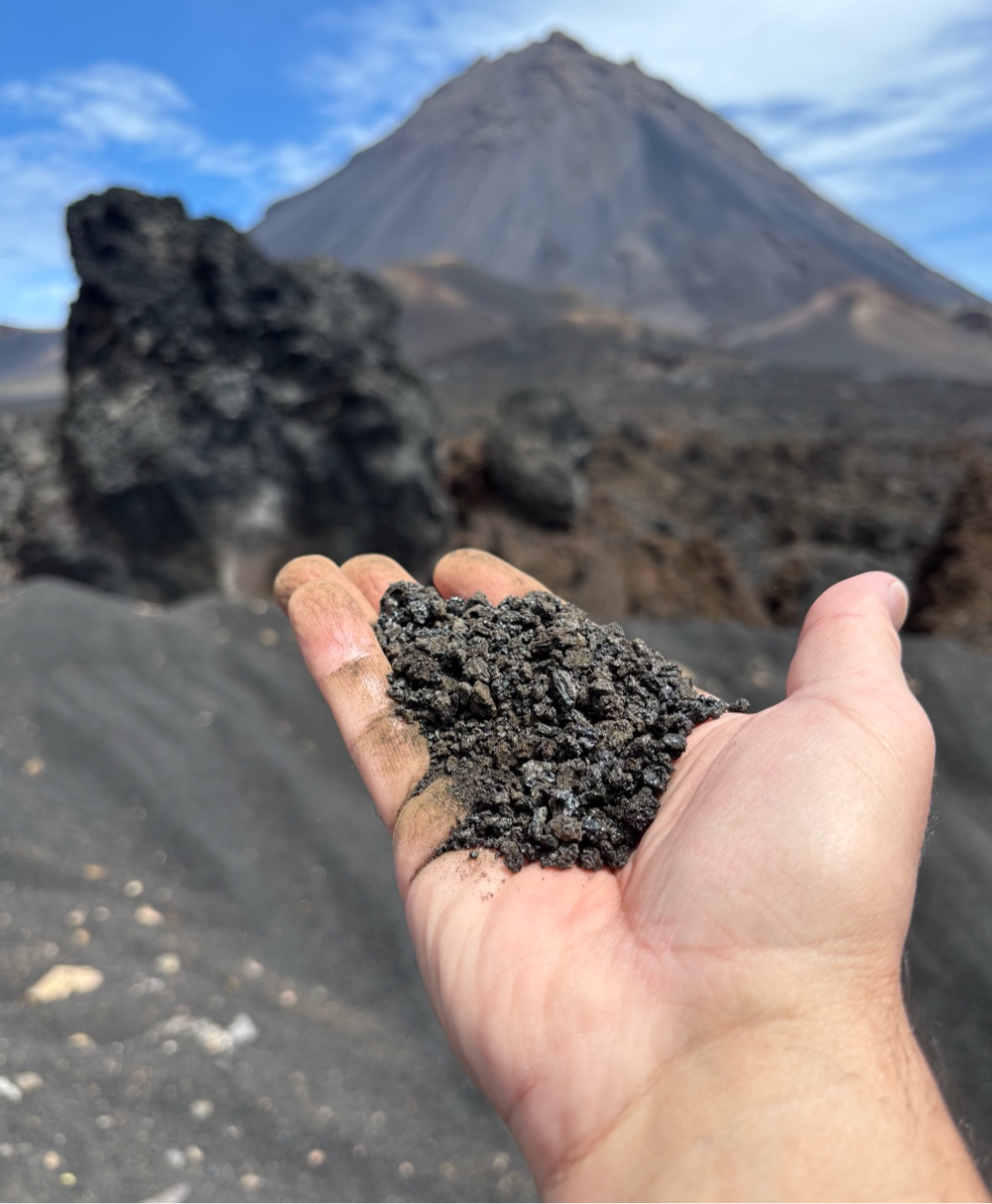 |
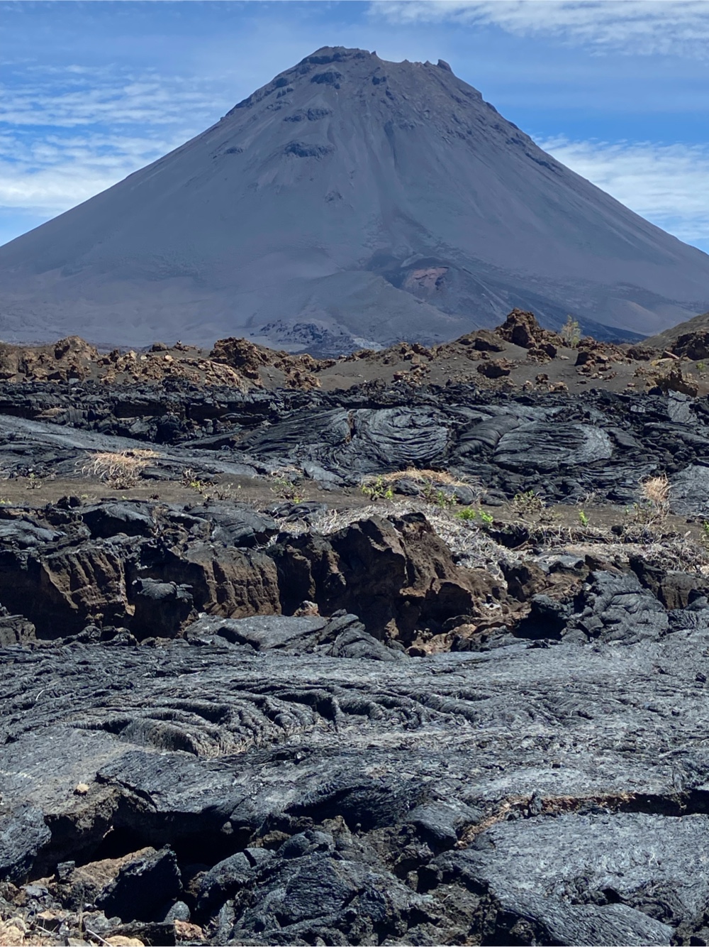
| Generally, volcanoes spew cinder ash and/or molten lava. Both can bury villages. Over the centuries, Fogo has spewed both. Cinder ash (shown) is like coarse sand. Molten lava globs along, crushing and burning everything in its path, and then hardens. |
 |
| The road inside the crater had to be rebuilt after the 2014-2015 eruption buried the previous cobblestone road. In the distance, you can see how they had to burrow through thick ash at points to build the new road. |
 |
| As you enter the crater, a couple of kilometres of the original road still exists. At the branch in the road above, the new road veers around the bend to the left. The old road (to the right) quickly comes to an abrupt end, as it is buried in a lava field. |
 |
| A lava flow from the 2014-2015 buried the old crater road from this point onward. |
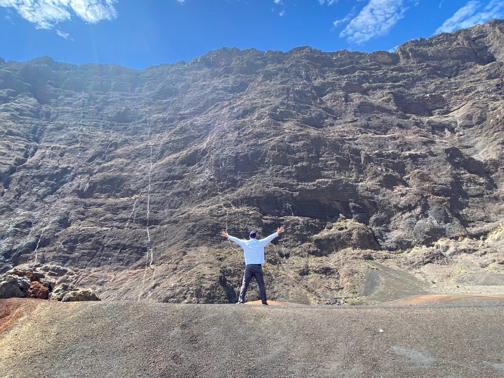 |
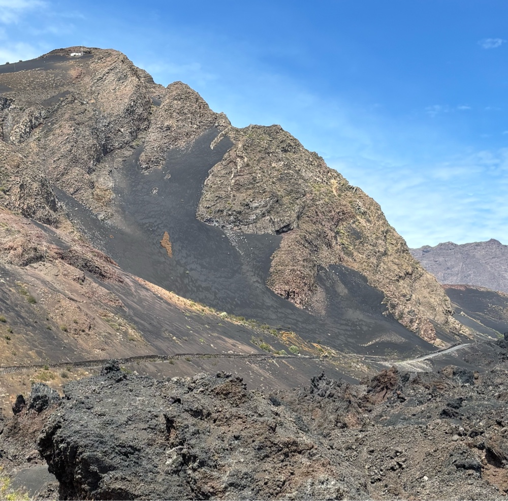
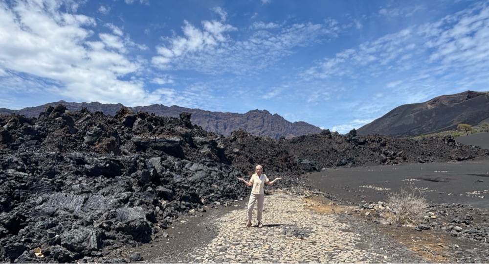
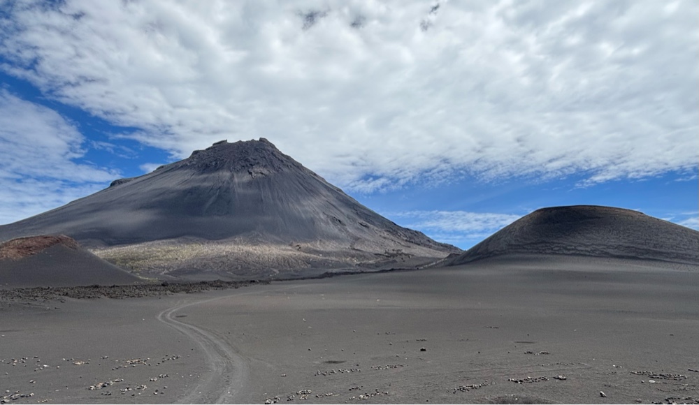
| The cone of the volcano is, of course, incredibly impressive. But equally impressive are the walls of the greater caldera surrounding the cone. |
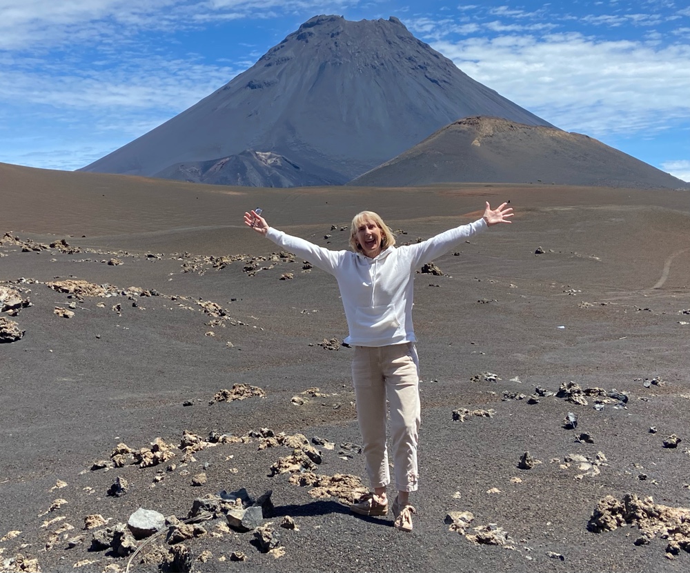 |
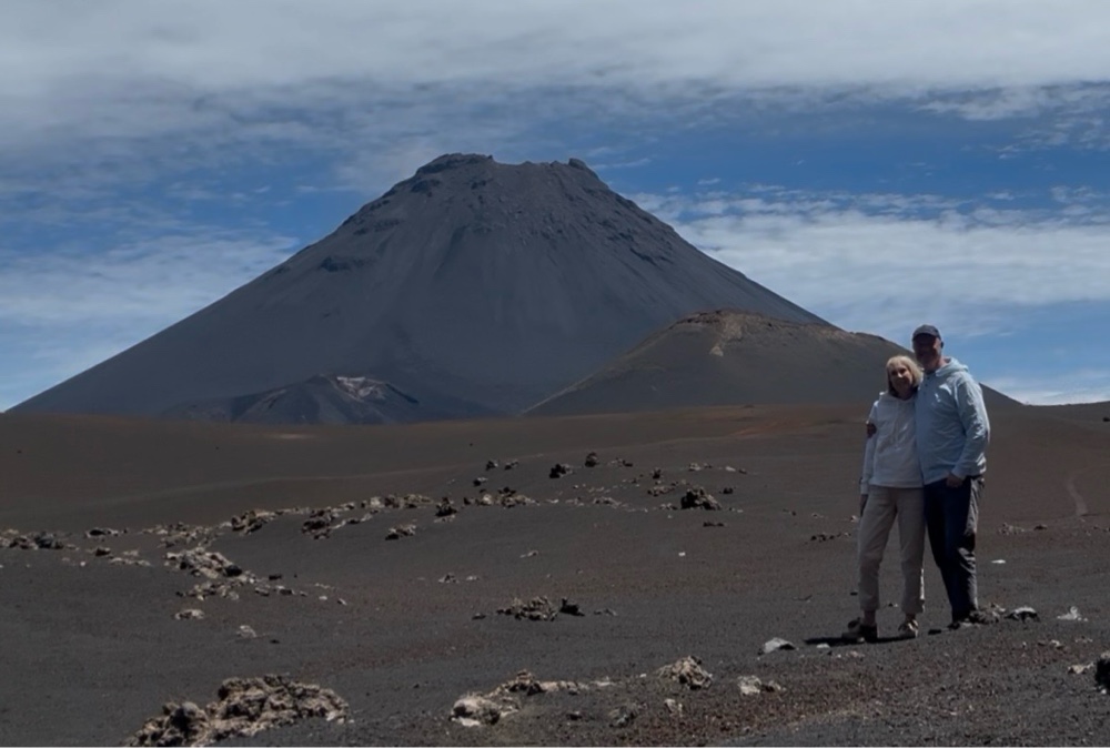
| I have rarely seen Pam so excited! She just loved being up there. |
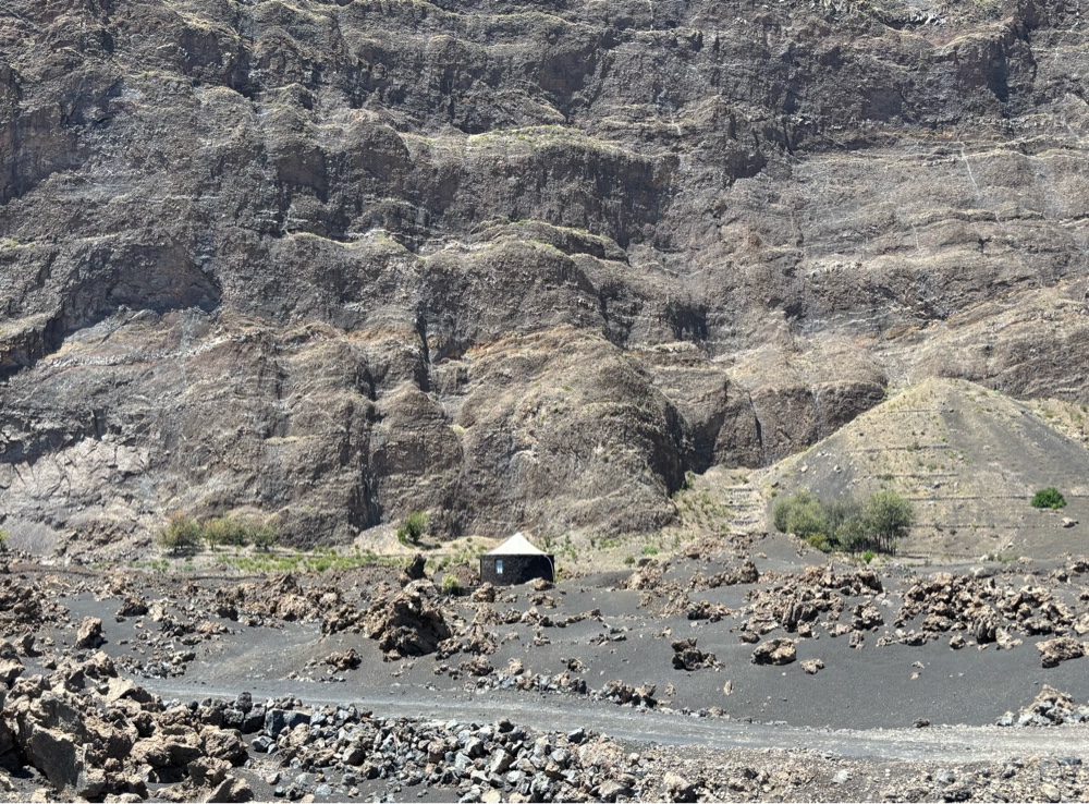 |
A lava rock hut is dwarfed by the sheer cliffs of the caldera walls.
|
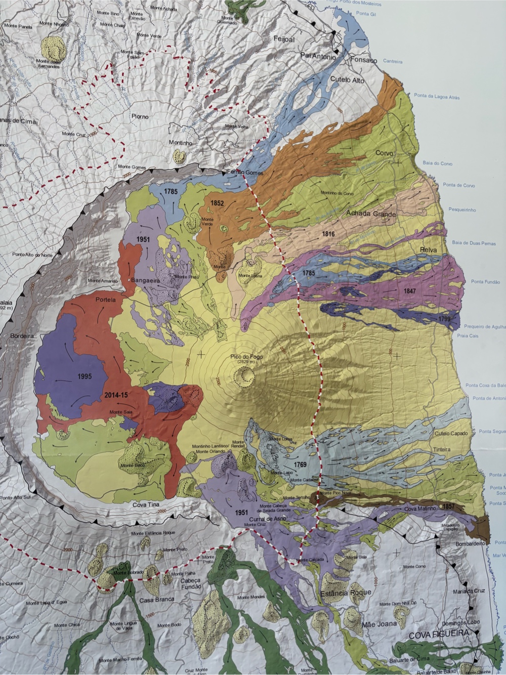 | | This map shows the lava flows associated with the various Fogo eruptions. The red shows the area covered by the 2014-2015 eruption. Dark purple shows the 1995 eruption. |
|
|
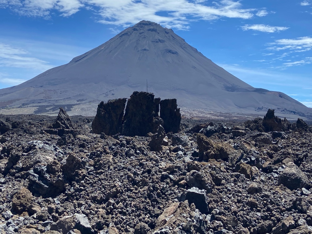 |
| Molten lava is weird stuff. As it globs along in molten form, it can take many forms, such as these pillars from the 2014-2015 eruption. |
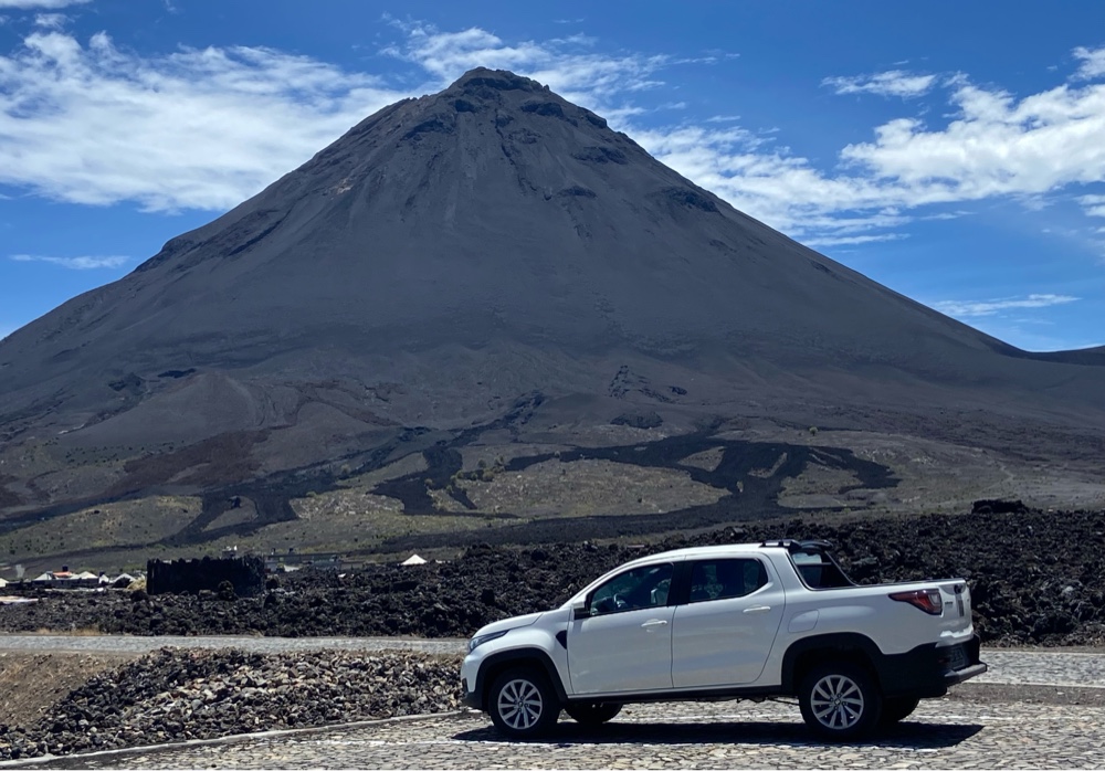 |
| The Fiat car-truck served us so well in the crater. |
 |
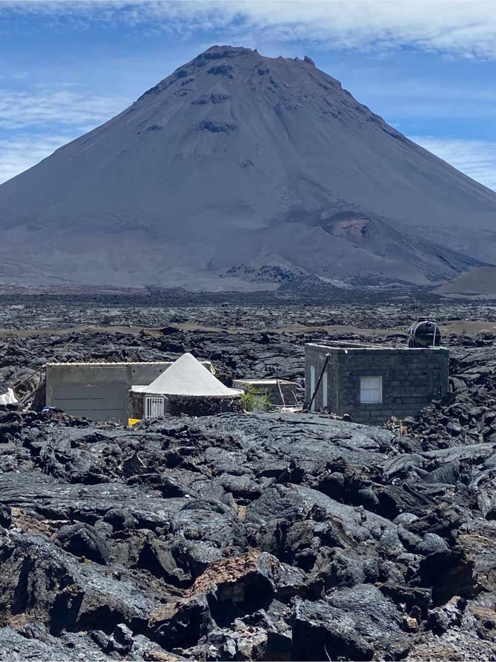
| This is the newly constructed village of Portela, which was buried by the 2014-2015 lava flows. |
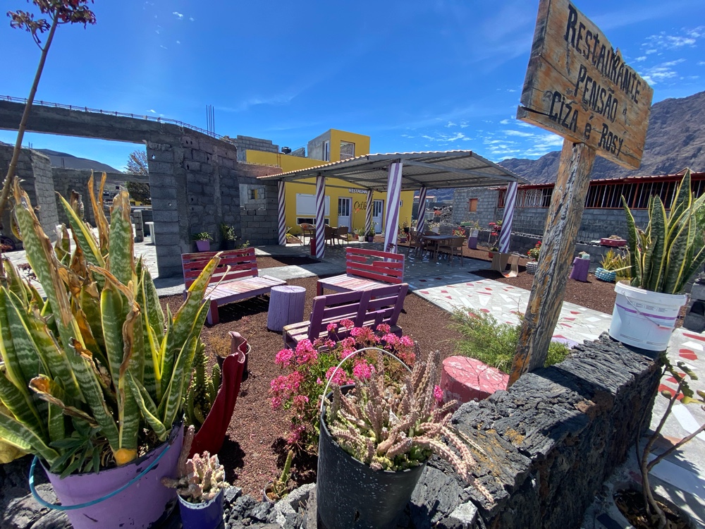 |
| Living in a landscape of black lava rock can be bleak. Some people have really tried to brighten things up on their property. |
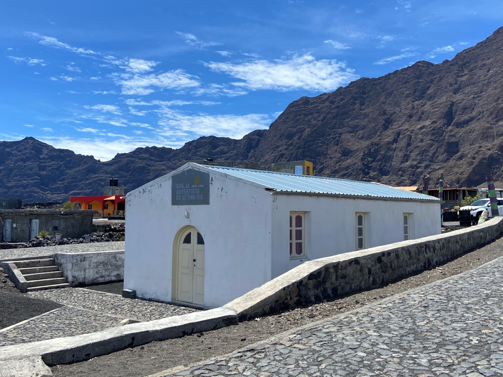 |
| The new Portela has everything you’d expect to find in a village, including a school and a church (above) (Seventh Day Adventist). |
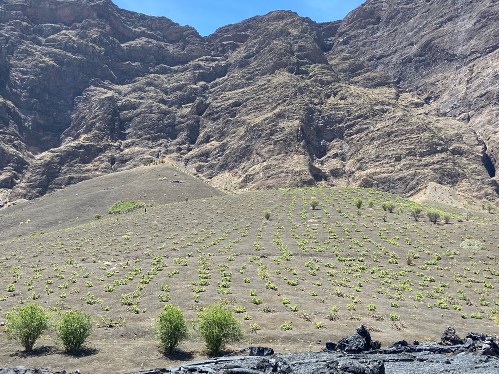
The was able to move some of the wine-making equipment in Portela to higher ground in the early days of the 2014 eruption. The winery was re-established, and the vines do well in the rich volcanic soil.
|
|
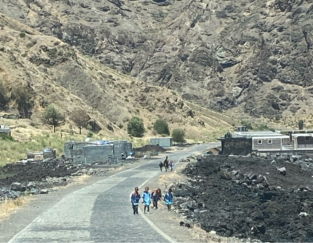 |
| School kids walking home at lunchtime. |
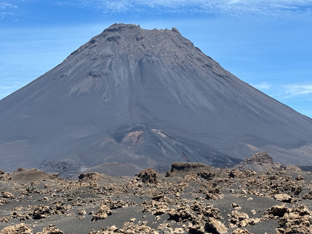 |
Lower center on the cone above, you can see the source of the 2014-2015 eruption.
|
 |
| Sorry for so many pics of the cone - it is simply very impressive, and every viewpoint seems to capture a nuance of it. |
 |
A view of the caldera road, juxtaposed against the walls of the caldera.
|
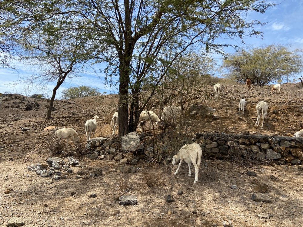 |
A flock of newly shorn sheep on the way down from the caldera.
|
Sao Filipe
Many people consider Sao Filipe (‘St. Philip’) to be the most pleasant settlement in the whole of Cabo
Verde. It is the fourth largest city/town in the country and is perched high on volcanic
cliffs. It is filled with renovated colonial-era houses called sobrados, boasting pastel facades.
 |
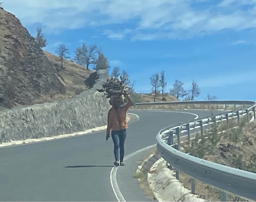
| The ingenuity of the folks from Fogo! |
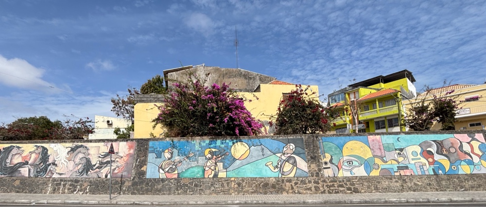 |
| Mural in the center of Sao Filipe, Fogo’s main town. |
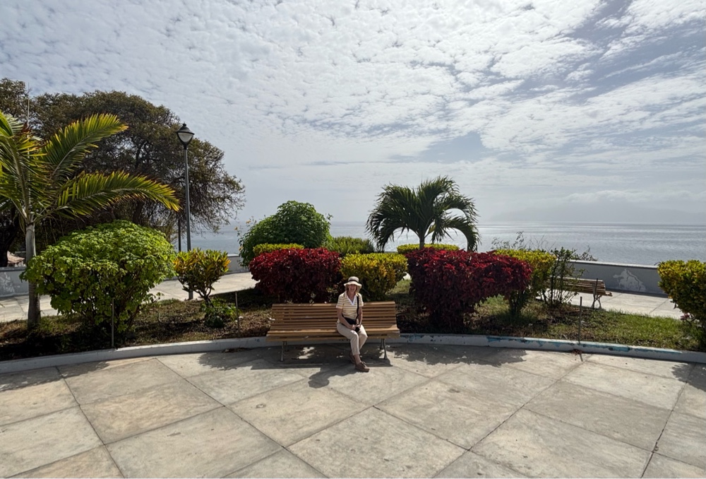 |
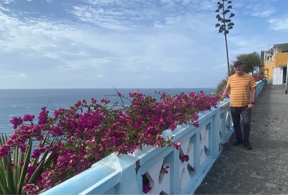
| A park on the top of the seaside cliffs. |
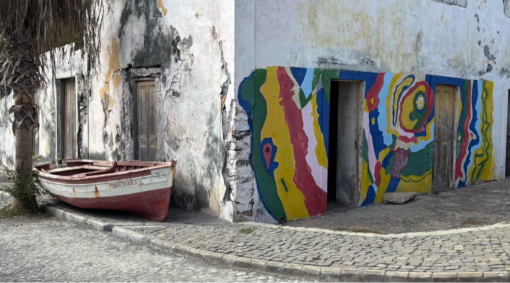 |
| I call this shot, “Beauty in Decay”. |
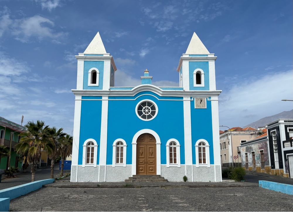 |
The blue-washed, double-spired Church of the Conception. |
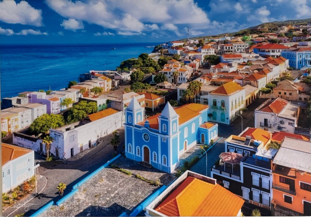 |
| This shot was actually taken by a drone. It was an enlarged photograph in the airport, so I took a picture of it to show an overview and the beauty of the centre of São Filipe. |
 |
| Atop the cliffs overlooking the black sand beach of Sao Filipe. |
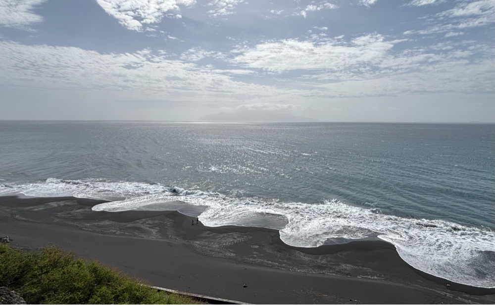 |
The black sand beach of Sao Filipe. It may look like an optical illusion, but the waves truly roll in, in a scalloped fashion.
|
 |
| The View — our hotel, perched on the cliffs north of the town, adjacent to the ferry landing. |
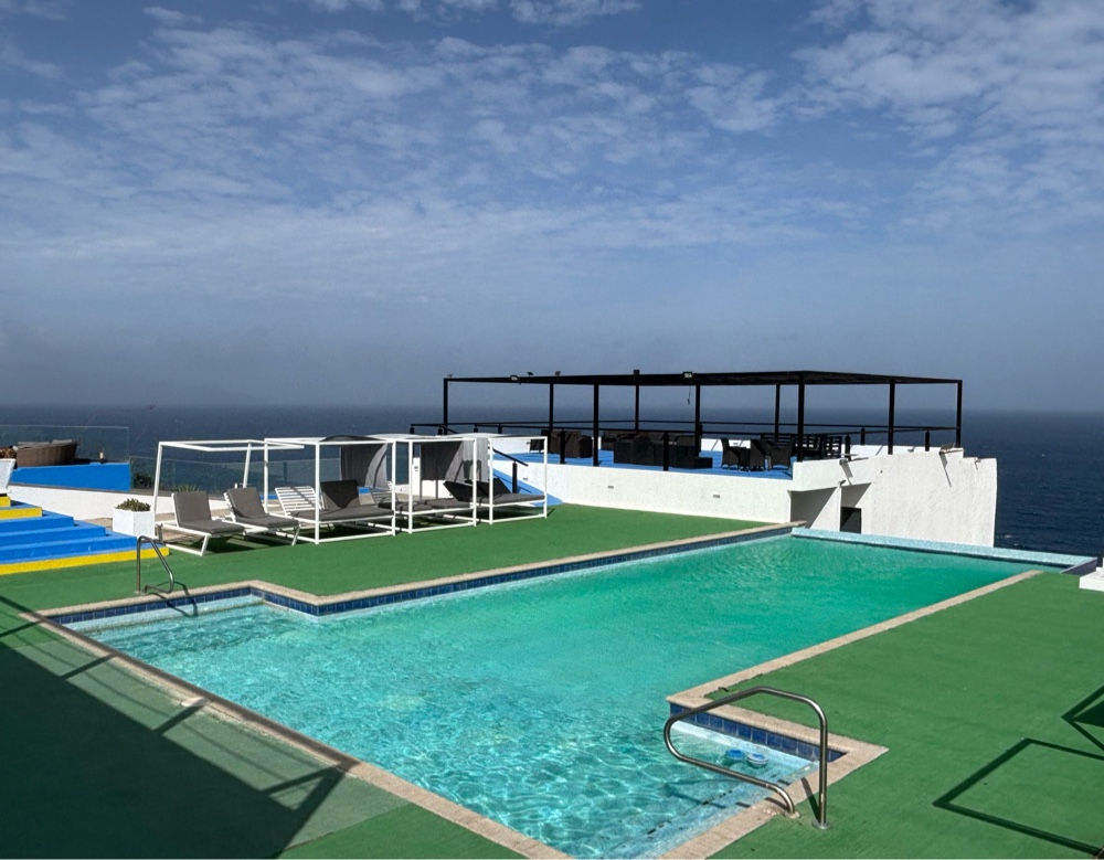 |
| We ended our exciting day, sitting by the pool and enjoying The View’s view! |
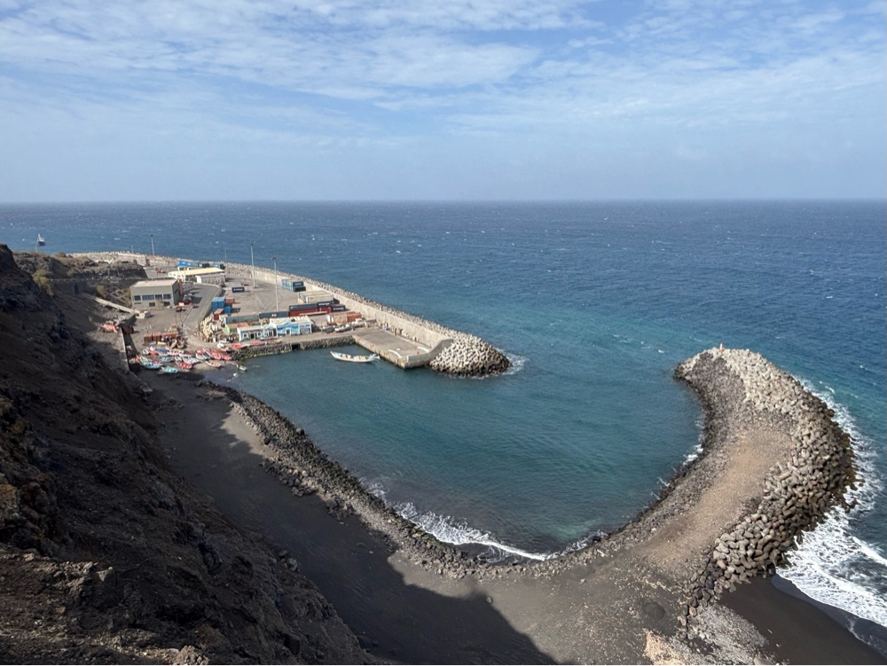 |
| The port of Sao Filipe, north of town, where the ferries from Santiago and Brava islands land, and where all the cargo for the island arrives. |


Comments
Post a Comment