This is the day we changed islands, from Santiago Island to Fogo Island. It was a 5:30 AM rise, in order to meet our prearranged taxi at 6:30 AM. The flight over to Fogo is just 30 minutes, but there are very few interisland flights, and they usually sell out. When we arrived at Nelson Mandela International Airport, the lineup to check in for our flight was long and tediously slow. And they have some of the most meticulous security screening procedures I’ve ever seen! All that to say, there was no time to spare. We pushed back at 7:50 AM and were on the ground in Fogo by 8:20. The rental car company had sent a representative to the tiny Fogo airport to meet us and drive us into Sao Filipe (the main town), where we organized the rental car paperwork. We got some money out of the bank, topped up our SIM card data, and at 9:30 AM set out to drive around the island.
We drove 93 km. It doesn’t sound like much, but on a rough cobblestone road, every kilometre is painful and slow. It took 61/2 hours to make our way around the island. At 4PM, we arrived back in Sao Philip and made our way to our hotel, which is located just north of town adjacent to the ferry landing. Having had such an early rise this morning, we chilled out in our room, from where we watched the sun set over neighbouring Brava Island, and then had dinner at the hotel restaurant.
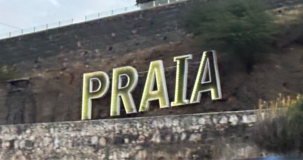 |
| Enroute to the airport, we passed the “PRAIA• sign on the cliffs of Plato. Farewell, Praia! |
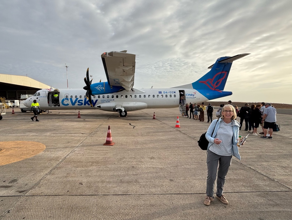 |
Boarding the packed Cabo Verde Airlines ATR-72-600 turboprop plane to Fogo. This is the aircraft type used to connect all the islands. You board from the rear, and the baggage compartment is just behind the cockpit.
|
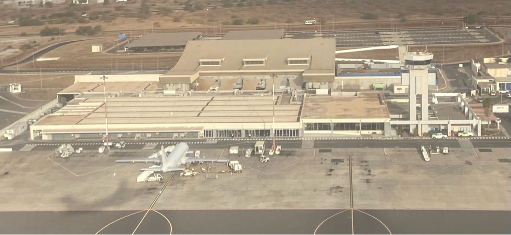 |
The view of Nelson Mandela International Airport in Praia upon takeoff. You can see our plane’s shadow on the tarmac.
|
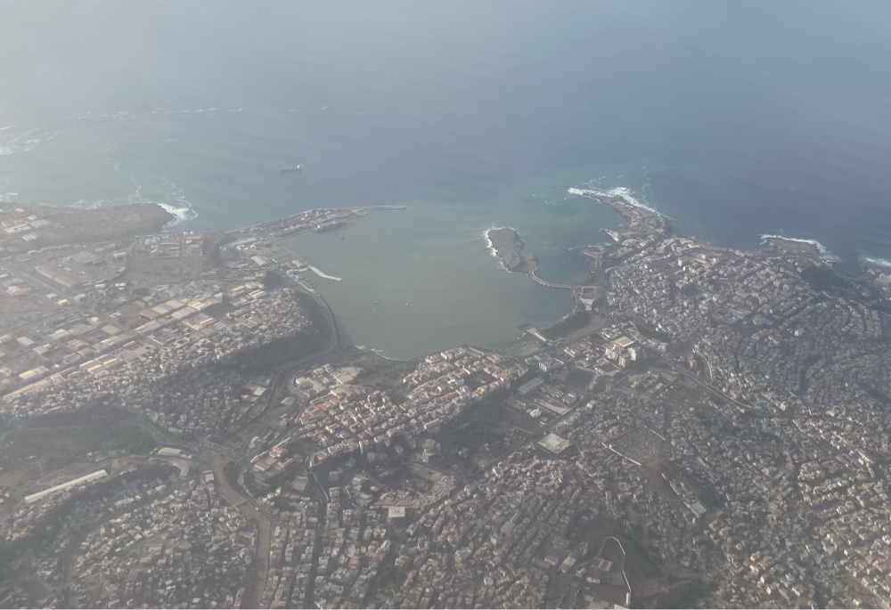 |
One last view of Praia.
|
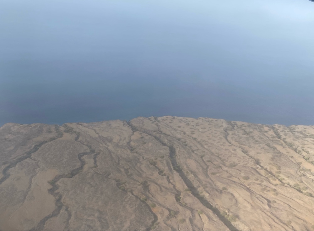 |
Our first view of Fogo. The volcano could only been seen from the other side of the plane, unfortunately. Our view was still useful, as it showed the lava trenches that pushed towards the sea from the volcano. Those trenches date back prior to recorded history.
|
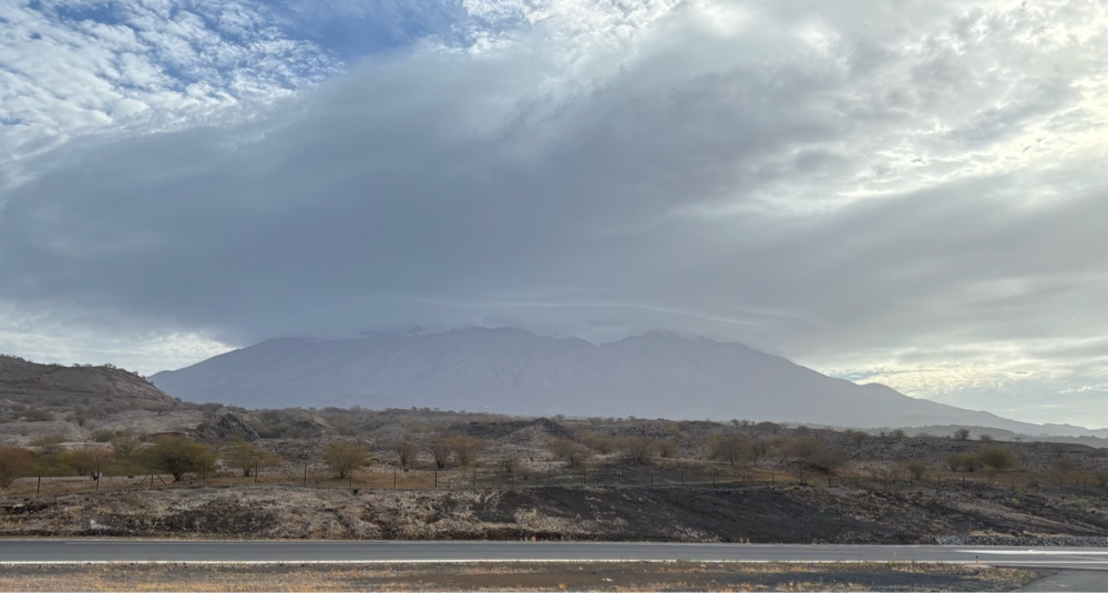 |
| As it turned out, the volcano was shrouded, so we wouldn’t have gotten a view of it, even if we had been seated on the other side of the plane. This is the view as we stepped off the plane. |
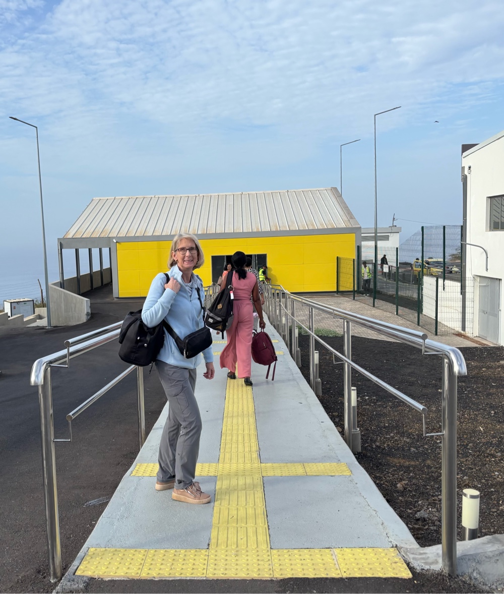 |
São Filipe’s airport is very small. The arrivals / baggage carousel section is housed in a separate building.
|
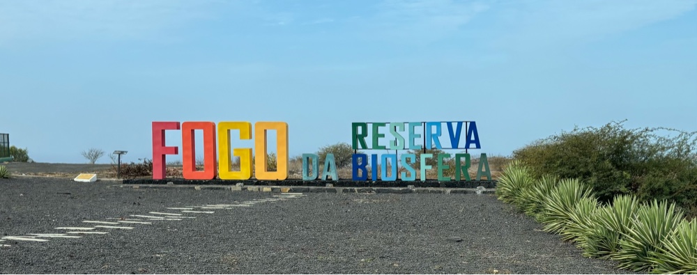 |
A sign near the airport reads, “Fogo da Reserva Biosfera” (Fogo Biosphere Reserve).
|
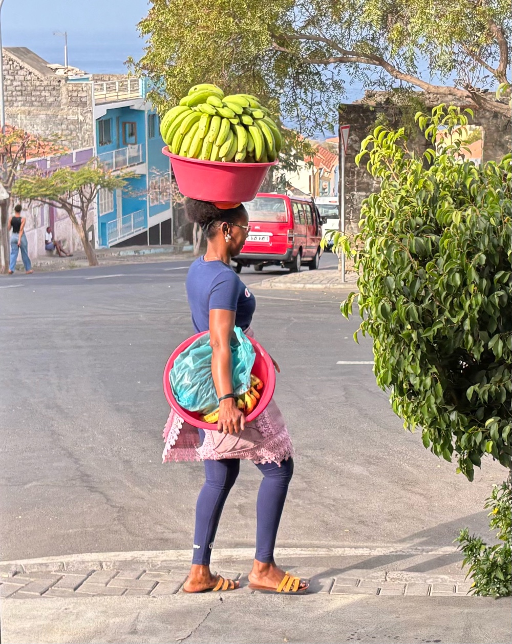 |
| Women carry their burdens on their heads here on Fogo, too! |
Our 93 km route today.
 |
 |
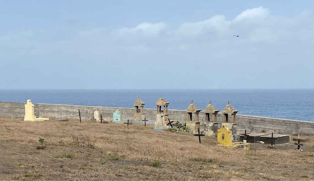 | | A typical Cabo Verde graveyard. |
|
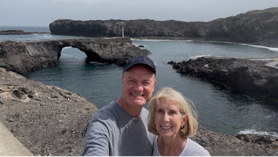
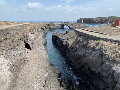 | | Just south of Sao Jorge, on the island’s west coast, is a ‘natural bridge’ (arch) and a ‘piscinas naturalis’ (natural swimming pool) called Ponta da Salinas. Almost every community in the Azores has a piscina naturalis, but here, they are few and far between. Basically, a calm inlet or cove is turned into a protected swimming area with man-made enhancements. |
|
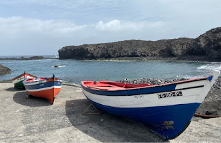 | |
Fishing boats at Ponta da Salinas
 | |
Rural church on the west coast.
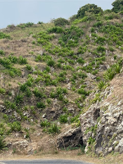 | |
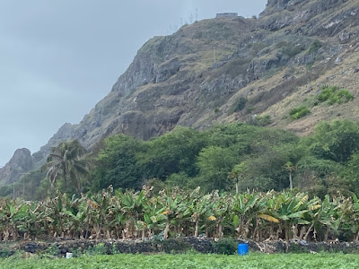
It takes hundreds of years before vegetation can establish itself on hardened lava.
 | | Driving around Fogo, you are quite struck by the fact that there are no flat spaces to speak of. The terrain slopes downward to the sea, often with dramatic cliffs and steep declines. When you reach the north coast, however, you notice a large flat area adjacent to the ocean, in the vicinity of Mosteiros. Give the absence of any such flat land up to this point on the round-the-island journey, the feature really stands out. On the island of São Jorge in the Azores, which has a similar coastal steepness, we learned about “fajas”. A faja is a coastal plateau, formed by landslides or lava flows, now calmed and settled. This is exactly what we saw in the vacinity of Mosteros. |
Bougainvillea spilling down over a cliff to the edge of the highway near Mosteiros.
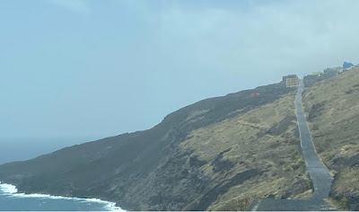
 | | The northernmost point on Fogo Island, at Ponta do Guincho. |
 | | Due to being located on a faja, Fajazinha, near Mosteiros, has a lot of flat land, making it an excellent area for coffee and fruit plantations. |
 | | Bizarre cliff features near Mosteiros. |
 | | In these parts, Mosteiros is famous for its arabica coffee beans. We stopped at a small restaurant recommended by Lonely Planet for an early lunch and some of the famous coffee. |
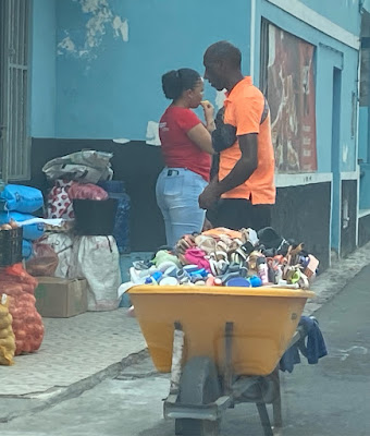 | | Mosteiros is a relatively small town but it is still the largest town on the north coast. Even in such a small town, clothing sellers are prolific, such as this guy, who was walking the main street with a wheelbarrow filled with shoes. |
 | Church of our Lady of Ajuda in Mosteiros.
|
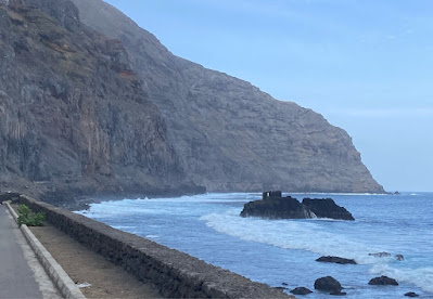
 | | A typical stretch of the ‘highway’ the encircles Fogo, as well as a typical view of the sloping terrain. |
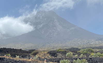 | | It wasn’t until we started down the east coast of the island that we were able to finally see the volcano peak. On the west coast, all you can see are the remaining walls of the calderal that surround the volcano peak. |
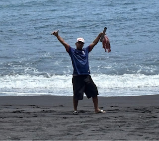
 | | Halfway down the east coast, we stumbled across an exit on the road that led down the cliff to the most incredible black sand beach. The photo lighting doesn’t give an accurate sense of just how black the sand is. |
 | | Fishermen had just come in with their catch and were sorting out their nets. One of them proudly showed us his string of red fish. |
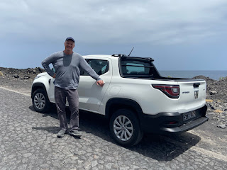 | | Up to this point, our French-made FIAT car-truck proved excellent for the terrain. |
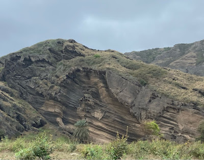
 | | Along the east coast of Fogo, we saw this lava field. We assumed it was relatively ‘fresh’ lava rock, possibly from the eruption of 2014. However, it turns out, it was from one of the eruptions in the 1800s, which goes to show that it takes hundreds of years before vegetation can begin to form on lava rock. My geologist neighbour informed me that this is called pahoehoe lava (a Hawaiian word); he explained hat the top crust cools, but the low viscosity lava in the center twists and rolls the outer crust. |
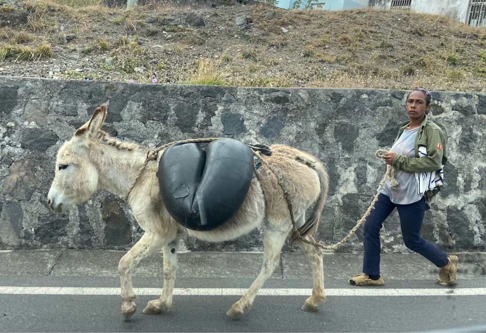
 | | Donkeys are still popular in Cabo Verde for transporting goods. This was the first person we saw using one moving himself! |
 | | Water is in short supply on Fogo. A rise in agriculture has placed great pressure on the limited water resources. In fact, when we checked into our hotel, tthere was no water in our room - the front desk told us the water supply was out that day until 6PM, as if it was just a regular occurrence. In any case, water sources in the mountains are tapped and collected in small local reservoirs like the one along the roadside in the photo above. |
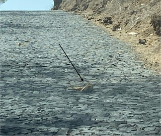 | The road that goes along the edge of Fogo’s coastline is 82km long. Most of it is comprised of cobblestones, and we were told that every cobblestone was hand laid. It all represents an incredible testament to human endurance. However, one has to be careful for loose stones, such as the one in the photo, which can destroy a tire in an instant.
|
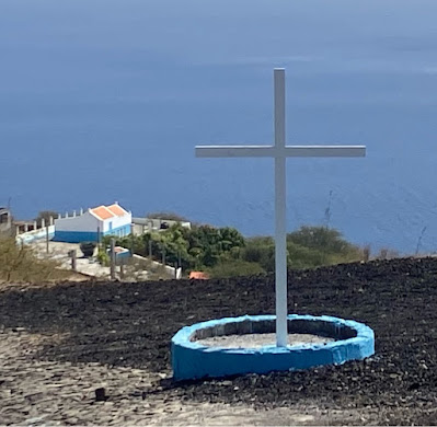 | | Apart from the volcano itself, Lonely Planet doesn’t list a lot of actual sights on Fogo. One of the sights it does list is the Chapel of Our Lady of Socorro, which was located down a 5km stretch of bumpy road near the end of our drive around the island. We felt it would be worth investigation! When we got there, however, we found the gate locked. That’s it to the left of the photo above. Apparently, the chapel was built to mark the miraculous statue of the Virgin Mary that was found by local shepherds. |
 | | A flock of roadside pea hens enroute to the Chapel of Our Lady of Socorro. |
 | | The sun is about to set over the neighbouring island of Brava, rounding out a wonderful first day on Fogo. |
|


Comments
Post a Comment